fbpx

Materials Library & Visual Styles

Materials Library & Visual Styles

Multiple Visual Styles & Materials Images Library

Realistic Visual Style & MaterialsCourtesy J. Dias, Architect

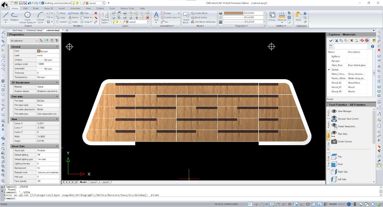
Starting from CMS IntelliCAD 10, users have the ability to apply an extensive range of materials images to CAD objects and render them dynamically using the Realistic Visual Style.

Along with the Realistic Visual Style, CMS IntelliCAD PE also supports 8 additional Visual Styles:
2D Wireframe, Conceptual, Hidden, Shaded, Shaded with Edges, Shades of Grey, Sketchy Wireframe & X-ray.

Geographic Mapping Image

Geographic Mapping Image

Geographic Map Location and Image

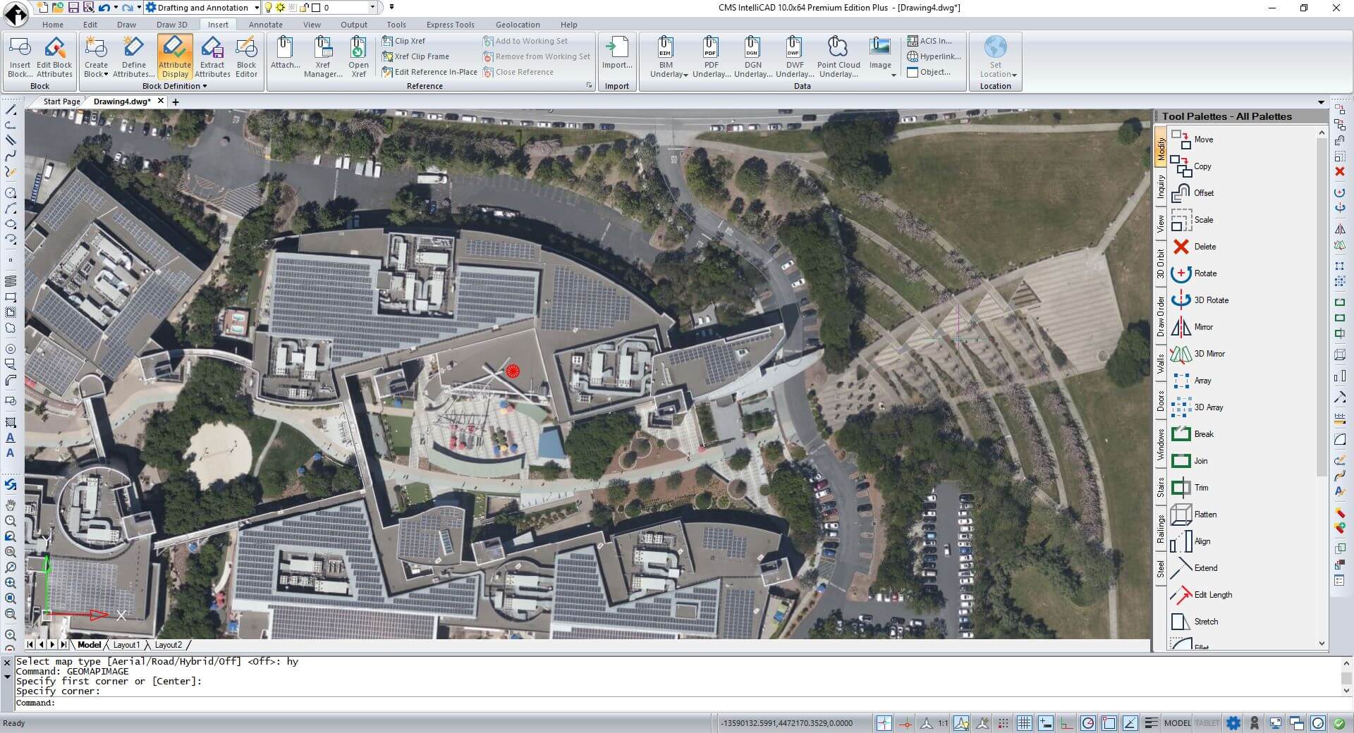
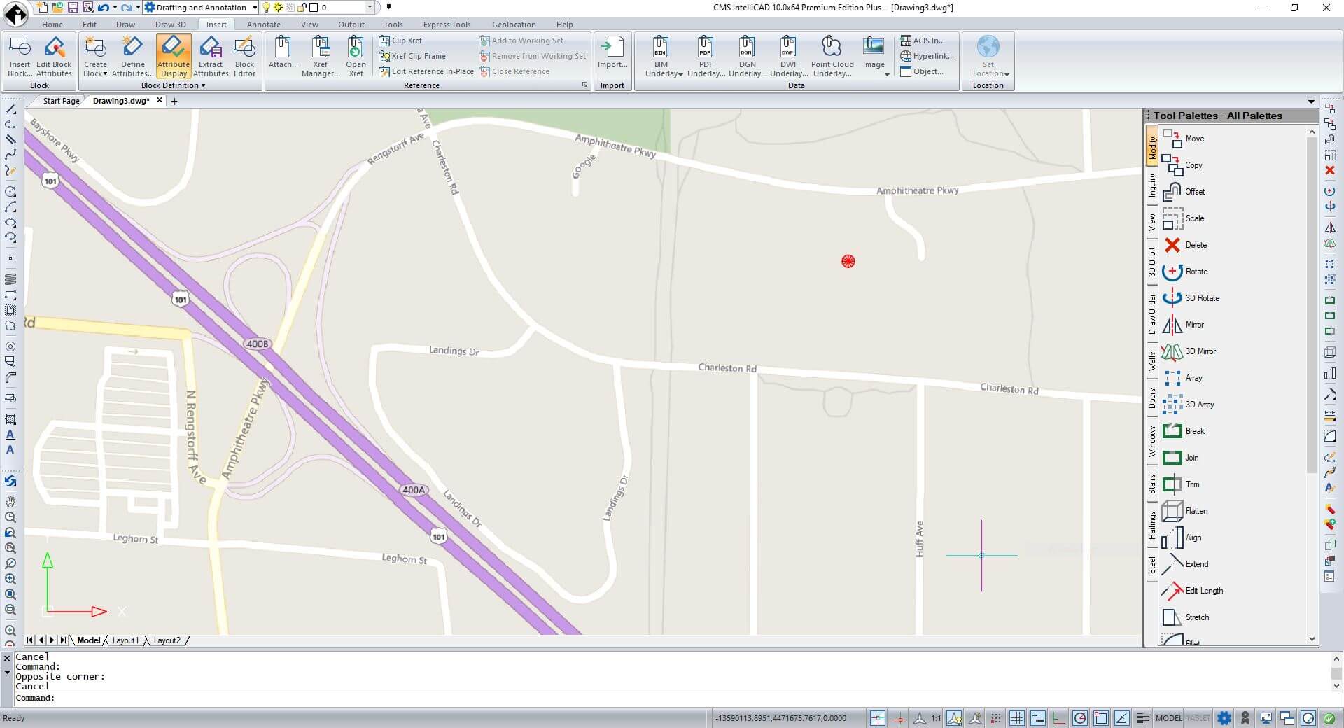
CMS IntelliCAD geographic map image insertion based on geographic location imported by .kml file

CMS IntelliCAD supports Geographic Location and Geographic Maps. It's now able to set geographic location data to the drawing. Users can either choose a file to set the geographic location using data from a .kml (keyhole markup language) or .kmz (compressed KML) file. The first location mark defined in the selected file is used to place the red geographic marker in model space. Alternatively, choose to locate the geographic marker by specifying its latitude and longitude.

Geographic Map can either be set as Aerial, Road or Hybrid. Users will be then able to retrieve and insert a geographic map image rectangular frame from the internet using GEOMAPIMAGE command.

Geographic Map image resolution can also be set from coarse to very fine.

CMS IntelliCAD geographic map image insertion based on geographic location imported by .kml file

Architectural Tool Palettes, Walls, Doors, Windows & Slabs

Architectural Tool Palettes, Walls, Doors, Windows & Slabs

Architectural, Engineering and Construction (AEC) Tool Palettes

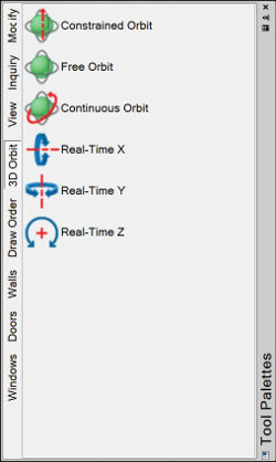
New Tool Palettes now comes with CMS IntelliCAD® 9.x PE and PE Plus software. Tool palettes feature provides a combined method for accessing tools. By merging toolbars and ribbons concepts, users can quickly access drawing, editing and exploring tools. Palettes categories can also be expanded or customized making it much easier to manage and custom. CMS IntelliCAD allow users to dock and auto-hide tool palettes.

Modify Inquiry View 3D orbit

AEC Objects, Walls, Windows, Doors, Openings, Stairs, Railings, Slabs and Steel (2D and 3D shapes)

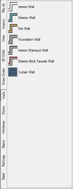
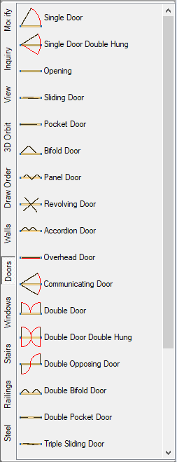
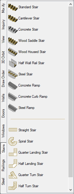
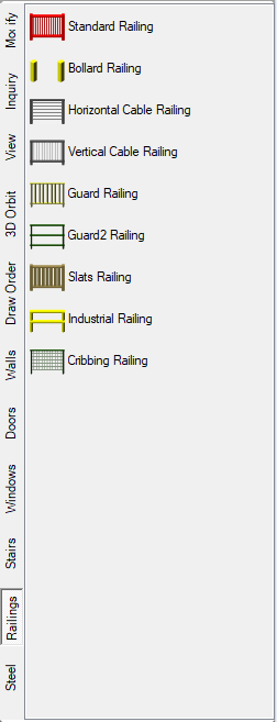
Additionally, only included in the CMS IntelliCAD PE PLUS tool palettes, users can draw an extended variety of AEC entities such as walls, doors, windows, stairs, railings and steel sections. Users can also reach the additional AEC entities at the DRAW Ribbon tab.

DRAW Ribbon tab

Walls Doors Windows Stairs Railings Steel

Raster Image Support

Raster Image Support

Raster Image Support

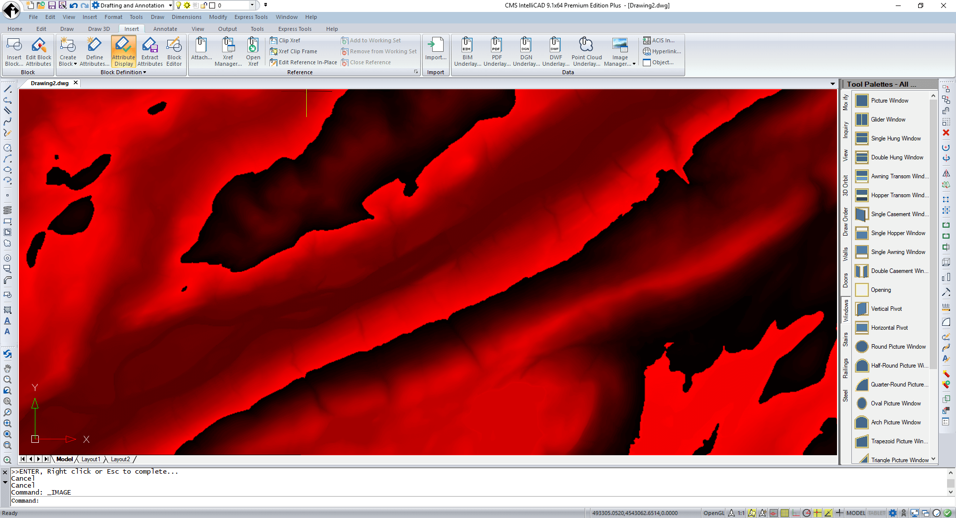
CMS IntelliCAD Raster Image AttachSample file at image credits to USGS - "ASTER GDEM is a product of METI and NASA."

CMS IntelliCAD supports Raster Image insertion as underlay. Images are stored as a raster. Additionally other technical data defined geometrically as points matrix can also be stored as raster. As example, each point can store data about an elevation measurement or temperature that can be then translated in to visual data like a color graded image.

The advantages are clear, simple data structure.

CMS IntelliCAD is impressively able to attach a huge number of data set file formats as listed below:

USGS ASCII DEM (*.dem)
USGS Digital Ortho Quad (*.doq)
USGS SDTS DEM (*.ddf)
ACE2 (*.ACE2)
ARC Digitized Raster Graphics (*.gen)
ASCII Gridded XYZ (*.xyz)
Arc/Info ASCII Grid (*.asc)
Arc/Info E00 (ASCII) Coverage (*.e00)
Arc/Info Export E00 GRID (*.e00)
Atlas BNA (*.bna)
AutoCAD DXF (*.dxf)
AutoCAD Driver (*.dwg)
Comma Separated Value (.csv) (*.csv)
Czech Cadastral Exchange Data Format (*.vfk)
DRDC COASP SAR Processor Raster (*.hdr)
DigitalGlobe Raster Data Access driver (*.dgrda)
ECRG TOC format (*.xml)
ENVI .hdr Labelled (*.*)
EPIInfo .REC (*.rec)
ERDAS Compressed Wavelets (SDK 3.x) (*.ecw)
ERDAS JPEG2000 (SDK 3.x) (*.jp2)
ERMapper .ers Labelled (*.ers)
ESRI .hdr Labelled (*.bil)
ESRI FileGDB (*.gdb)
ESRI Personal GeoDatabase (*.mdb)
ESRIJSON (*.json)
EUMETSAT Archive native (.nat) (*.nat)
Envisat Image Format (*.n1)
Erdas Imagine Images (.img) (*.img)
FARSITE v.4 Landscape File (.lcp) (*.lcp)
FIT Image (*.*)
French EDIGEO exchange format (*.thf)
GMT ASCII Vectors (.gmt) (*.gmt)
GMT NetCDF Grid Format (*.nc)
GPX (*.gpx)
GeoPackage (*.gpkg)
GeoSoft Grid Exchange Format (*.gxf)
GeoTIFF (*.tif)
Geography Markup Language (GML) (*.gml)
Geomedia .mdb (*.mdb)
Geospatial PDF (*.pdf)
Golden Software 7 Binary Grid (.grd) (*.grd)
Golden Software ASCII Grid (.grd) (*.grd)
Golden Software Binary Grid (.grd) (*.grd)
Graphics Interchange Format (.gif) (*.gif)
Ground-based SAR Applications Testbed File Format (.gff) (*.gff)
HF2/HFZ heightfield raster (*.hf2)
Hierarchical Data Format Release 4 (*.hdf)
IHO S-57 (ENC) (*.000)
IRIS data (.PPI` .CAPPi etc) (*.ppi)
Idrisi Raster A.1 (*.rst)
Idrisi Vector (.vct) (*.vct)
JPEG JFIF (*.jpg)
JPEG-2000 driver based on OpenJPEG library (*.jp2)
Japanese DEM (.mem) (*.mem)
KEA Image Format (.kea) (*.kea)
KOLOR Raw (*.kro)
Keyhole Markup Language (KML) (*.kml)
Leveller heightfield (*.ter)
MBTiles (*.mbtiles)
MS Office Open XML spreadsheet (*.xlsx)
MS Windows Device Independent Bitmap (*.bmp)
Magellan topo (.blx) (*.blx)
Meta Raster Format (*.mrf)
Microstation DGN (*.dgn)
MrSID Generation 4 / Lidar (.sid) (*.view)
Multi-resolution Seamless Image Database (MrSID) (*.sid)
NAS - ALKIS (*.xml) NASA Planetary Data System 4 (*.xml)
NOAA NGS Geoid Height Grids (*.bin)
NOAA Vertical Datum .GTX (*.gtx)
NTv2 Datum Grid Shift (*.gsb)
Network Common Data Format (*.nc)
Northwood Classified Grid Format .grc/.tab (*.grc)
Northwood Numeric Grid Format .grd/.tab (*.grd)
Open Document/ LibreOffice / OpenOffice Spreadsheet (*.ods)
OpenJUMP JML (*.jml)
PCIDSK Database File (*.pix)
PCRaster Raster File (*.map)
Portable Network Graphics (*.png)
PostgreSQL SQL dump (*.sql)
R Object Data Store (*.rda)
R Raster (*.grd)
Racurs PHOTOMOD PRF (*.prf)
Raster Matrix Format (*.rsw)
Raster Product Format TOC format (*.toc)
Rasterlite (*.sqlite)
SDTS Raster (*.ddf)
SGI Image File Format 1.0 (*.rgb)
SRTMHGT File Format (*.hgt)
Scalable Vector Graphics (*.svg)
Snow Data Assimilation System (*.hdr)
Standard Raster Product (ASRP/USRP) (*.img)
Storage and eXchange Format (*.sxf)
Swedish Grid RIK (.rik) (*.rik)
Terragen heightfield (*.ter)
USGS Optional ASCII DEM (and CDED) (*.dem)
VRT - Virtual Datasource (*.vrt)
VTP .bt (Binary Terrain) 1.3 Format (*.bt)
Vexcel MFF Raster (*.hdr)
Virtual Raster (*.vrt)
WAsP .map format (*.map)
X-Plane/Flightgear aeronautical data (*.dat)
X11 PixMap Format (*.xpm)
ZMap Plus Grid (*.dat)

Photorealistic Shading and Rendering

Photorealistic Shading and Rendering

Photo-realistic 3D Real time shading and Professional photo-realistic Ai 3D Rendering and Lighting
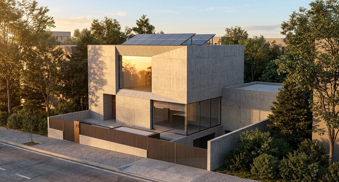
Courtesy J. Dias, Architect & VHN Engineering

CMS IntelliCAD 15 brings next-generation technology to your fingertips. Create detailed 2D or 3D designs using our robust drawing tools and generate photorealistic AI renders(*) straight from the model space. Just enter a prompt, click a button, and watch your vision come to life.
(*) Rendered images may not retain the exact input geometry and could include minor AI-generated elements or alterations to the original scene.

A tool exclusive to CMS IntelliCAD software only. Just set the view and run AIRENDER command. Generate professional, photorealistic images in seconds—not minutes. Simply write an AI prompt describing your ideal materials, backgrounds, and intricate details, and let CMS IntelliCAD’s sophisticated tools bring your vision to life instantly.. Literally unbeatable productivity.
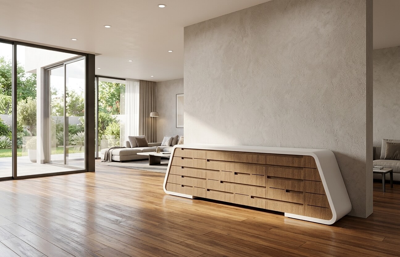
Courtesy J. Dias, Architect

This Ai render tool is included in ALL CMS IntelliCAD 15 - and following versions - (all versions)

Courtesy Flexcrane, Inc.

Courtesy Flexcrane, Inc.

How do I improve 3D visualization from a wireframe view?
If overlapping lines make your 3D models hard to read in wireframe view, you can improve visibility in two ways. Use a suitable VISUAL STYLE to hide edges obscured by front-facing surfaces. For a more solid look, you can apply a material to a layer, which hides background lines and fills visible surfaces with flat colors. While shaded images lack deep definition, they are the fastest way to dynamically visualize your 3D model as a solid object.


Rendering provides an even more realistic image of your model, complete with light sources, shadows, surface material properties, and reflections, or simply by prompting for a scene, giving your model a photo-realistic look. When you render a model from CMS IntelliCAD model space using a design that can have assigned materials and lights, our rendering tool removes all auxiliar and unnecessary design data, e.g., grid and auxiliar lines.

Ai rendered image from a chair design CMS IntelliCAD in model space